How To Create Your Own Custom il Map
- Complete the payment
- Check Your Email Inbox
- Start Editing. Add your colors, links, images, etc
- Save your Map
- Share it or Set it up in your website
Illinois County Map
Use our Map App to create your own Illinois county map.
Here's what you can do with it. Change individual colors, change labels, make it clickable, interactive, add popups, or just export it as an image.
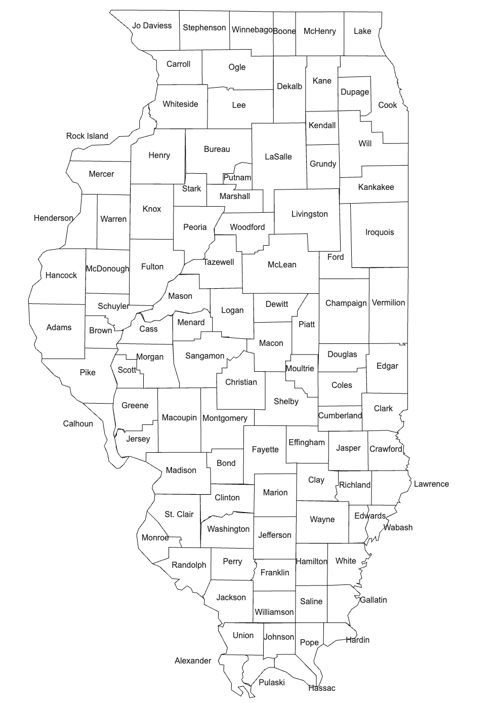
Blank Illinois County Map
Don't need to customize it? Click below to download the printable Illinois blank map
Click Below to download
Blank Illinois County Map
A Guide to Illinois's Counties
Illinois, situated in the Midwestern region of the United States, is segmented into 102 distinct counties. Each one contributes its own flair and historical significance to the state's rich tapestry. This map offers a focused perspective on these administrative units, giving users an insightful look into Illinois's structural composition and its county boundaries.
To discover more, simply hover over a specific section of the map. As you do, the name of each county will emerge. From Cook to Sangamon, and Champaign to Rock Island, every county has a story to tell and a role in shaping Illinois's legacy.
Presented without additional elements, this map emphasizes the clear demarcations of Illinois's county boundaries. These borders, influenced by historical events and politics, offer a glimpse into the state's developmental journey and its multifaceted identity.
Whether you're an educator, a researcher, or someone with an avid interest in the Prairie State, this interactive map serves as an invaluable resource. It highlights Illinois county by county, presenting a detailed overview of its administrative divisions.
Venture through the counties of Illinois and gain a deeper appreciation for the complexity and beauty of this iconic state.
List of Illinois Counties:
Illinois is divided into 102 counties which are all represented in the map of Illinois. Here's a list of all of them, featured in the Illinois Counties map:
-
Adams
-
Alexander
-
Bond
-
Boone
-
Brown
-
Bureau
-
Calhoun
-
Carroll
-
Cass
-
Champaign
-
Christian
-
Clark
-
Clay
-
Clinton
-
Coles
-
Cook
-
Crawford
-
Cumberland
-
DeKalb
-
DeWitt
-
Douglas
-
DuPage
-
Edgar
-
Edwards
-
Effingham
-
Fayette
-
Ford
-
Franklin
-
Fulton
-
Gallatin
-
Greene
-
Grundy
-
Hamilton
-
Hancock
-
Hardin
-
Henderson
-
Henry
-
Iroquois
-
Jackson
-
Jasper
-
Jefferson
-
Jersey
-
Jo Daviess
-
Johnson
-
Kane
-
Kankakee
-
Kendall
-
Knox
-
Lake
-
LaSalle
-
Lawrence
-
Lee
-
Livingston
-
Logan
-
Macon
-
Macoupin
-
Madison
-
Marion
-
Marshall
-
Mason
-
Massac
-
McDonough
-
McHenry
-
McLean
-
Menard
-
Mercer
-
Monroe
-
Montgomery
-
Morgan
-
Moultrie
-
Ogle
-
Peoria
-
Perry
-
Piatt
-
Pike
-
Pope
-
Pulaski
-
Putnam
-
Randolph
-
Richland
-
Rock Island
-
Saline
-
Sangamon
-
Schuyler
-
Scott
-
Shelby
-
St. Clair
-
Stark
-
Stephenson
-
Tazewell
-
Union
-
Vermilion
-
Wabash
-
Warren
-
Washington
-
Wayne
-
White
-
Whiteside
-
Will
-
Williamson
-
Winnebago
-
Woodford
Can you find them all on our map of Illinois?
For even more different kinds of maps, contact us for a custom design if you like!
About the map
This clickable, interactive detailed map shows the U.S. State of Illinois and its counties.
Create your own interactive and clickable Illinois Counties Map!
A no-code way of creating a highly editable HTML custom clickable IL County map with county boundaries.
Easy to create, customize, and use on your own website!
Quick setup and editing process.
Once you are happy with the design, you save your map of Illinois counties and you get a code to embed your map on your website once.
Need a special feature? Contact us and get a quote for a custom map.
Some of our Interactive IL County map features:
-
Link to pages, files, and anything you want.
-
Enable clickable popups with multiple links, content, and images.
-
Add Multiple Links to each Popup
-
Link to other individual county maps.
-
Change the colors for each individual county
-
Disable countries to your preferences
-
Create World regions and give them individual colors
-
Create Any World Map You Want!
-
Clickable Maps, Content Maps with Popups, Statistic maps, Political maps, World maps with custom labels, business locations, United Nations, you name it.
-
Start Now and Make your own Illinois map with counties
-
And many more
